Friday, July 20, 2018

Margaret River Coast

Thursday. One more day in Western Australia. And an entire state one-third the size of Australia still to see. What to do? We opted to drive around the Margaret River area, south of Perth.

We first drove to the very bottom of the region, Cape Leeuwin, and its lighthouse -- mainland Australia's tallest lighthouse, said the sign.


It is also the end of a somewhat famous five day, 150 km walk -- that we did not take.


The lighthouse lies at the most southwestern point of Australia, at the meeting of two oceans. But it's still a very long way to the South Pole, as this sign pointed out.


We totally lucked out on the weather. Bright blue skies and 20 degree days (that's Celsius -- in Fahrenheit it was about 68 degrees).


The sign points out the two different oceans. I don't think I've ever stood on the border of two oceans before.

Some people at the lighthouse said that whales were breaching in the distance. Our tourist map also had a picture of whales at Cape Leeuwin, and stated that whales migrate there between June and August. We were between June and August. So we spent a very long long time staring out at the ocean trying to see a whale.

Grandma thinks she saw one. Tim thinks he saw one. Jonathan and I just shrugged our shoulders.

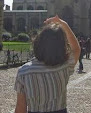
Do you see any whales out there?


I forget why I wanted to post the next picture. I guess it looks pretty?


Anyway, this is the best we could do on the whale spotting that morning.


So back in the car, we headed to our next stop.

If we can't see whales, maybe we can see some sting rays? I read on the internets that sting rays patrol the beach in Hamelin Bay. Not just the small rays -- we're talking about the rays that are a metre across. Huge and beautiful and right there on the internet pictures. Right there! So we had to go find them.


Off to a good start -- rays have been seen there before, says the sign above. Below, Tim scanning the water for rays.


Tim, Grandma, and Jonathan still scanning for rays. Or maybe just walking/jumping.


But again, the sign at the beach was the best we could do for ray sightings: (I don't think they hang out there in the winter.)


The beach was gorgeous. White sand, empty of people. Beautiful waves. But it was windy -- some rain was on its way in. I did not regret having no swim suit. Too cold.


Goodbye Hamelin Bay with your white sands and summer sting rays. Back in the car, we headed north again along Caves Road.

This area of the country is full of limestone caves. You can sign up for tours in about six or seven different caves all just a few kilometres from the coast. We stopped at Mammoth Cave, which did not require a pre-booking for a tour, and was reported to be large and wide to keep all the claustrophobic people in our car sufficiently happy.

Here is a picture of Jonathan and Grandma with their Mammoth Cave Audio Tours.


The mouth of the cave had teeth.


The inside also had teeth. And ribbons and flow stone and columns. It was impressive.


Although most of my photos did not turn out well, as is typical for cave photos, taken in the dark.


Here is Tim, climbing out of the cave at the end of the audio tour.


And the exit from the cave -- also a hole with teeth.


From the cave, there was a short nature walk back to the car. I finally got a picture of one of the cool grass-palm trees that we had been seeing earlier in the day. So there was that.


And there was a small stream crossing, absent the stream -- which, apparently, usually flows by July. Hopefully the stream comes back or that may be bad news for the cave.


In any case, that was the end of our cave tour.

Final stop: Redgate Beach.

Jonathan likes to scramble on rocks on the side of the ocean, so I picked this beach for him. It was supposed to have some nice rocks to view and climb. The sign at the beach reminded us that there were also strong rip currents, large waves, slippery rocks, and SHARKS!


There were indeed some rocks.


And SHARKS! Someone had very recently spotted a shark in the ocean there. So the beach was closed to swimming. We weren't going swimming anyway. But maybe we would see a shark??? That would be cool!


Here is a picture of Tim, looking for sharks.


Jonathan went scrambling on the rocks (mostly well away from the water -- he was safe).

(See? Being safe. And plus, I climbed along after him. Because I am a paranoid mother.)


Tim and Grandma, contemplating life and looking for sharks.


We did see some large waves, crashing in a most impressive manner over the rocks further out to sea. Even my phone camera makes the beach look spectacular. A better camera would have made it look amazingly spectacular.


But alas, no shark sightings. No whales, no rays, no sharks. We did see a large number of crabs. So that counts for something.

Oh, I forgot. There was one more stop: our road home passed by the Tuart Forest National Park. So I instructed Tim to drive along the road through the forest, parallel to the main highway, so we could check out the trees there. They looked like this:


There were supposed to be two kinds of possums living there, but it was too bright outside for possums. We did see ring-necked parrots, which only live in Western Australia, so even this stop was a success -- right up until Grandma spotted a single mosquito, and we all ran screaming back into the car.

And that was the end of Thursday.

And Friday we flew home. So that was the end of the vacation.

Phew! I hope you enjoyed re-living our adventures through my photos.

The End.

Thursday, July 19, 2018

Trees

Wednesday morning. On the road again. This time heading east and inland.


We were driving to a place called the Valley of the Giants, a three hour drive from where we were staying. Three hours is a long time to be in the car, Jonathan and I agreed. So I picked a spot half way there for a break.

Tim was against stopping, but he was overruled.

We stopped in early morning at Manjinup Timber Park.

On first glance, Manjinup Timber park seemed pretty cool. There were toilets with both soap and paper towels. That's pretty nice.

Around the building from the toilets, there was a huge log. That's pretty cool.


And this nice bridge over a little river. That's not bad.


I was pointing out all the nice things about the stop, showing Tim how wrong he had been to try to veto, when we crossed out of the trees and saw this in the distance:


A giant slide.

And as we watched, a little kid, maybe five years old, crawled out of the slide.

"You went down again?" an adult mother-figure asked him as he skipped away, as though he had just done something routine. Not as though he had just slid down the most massive slide I have ever seen in my entire life.

So Jonathan and I decided to climb to the top. And this is what the view looked like from way way up there.  Those tiny dots are Tim and Grandma.


Or you could look beyond Tim and Grandma, out into the far far distance -- we were that high.


The far far distance in another direction:


Time to go down. Jonathan was already nervous enough to be on the top of that huge tower. Plus he read the Slide Rules of Play:


"You are advised not to use the slide if you have ... back/neck problems."

"Oh, I strained my back last week, so I'm not going down," he said, and walked back down the stairs.

I had no such excuse. So I stood there a little while, and looked down the tube.


And looked around the tube. That's pretty steep. And a pretty long drop. What if I get stuck, like Homer Simpson in the waterslide?


After considering for a little while longer, I came to the reasoned conclusion that I should do it! And so I did.


That was totally awesome!


Let's do it again!

Only then we found the ziplines. Everyone was down for the ziplines.


Even Grandma.


Wow. What an awesome stop. So glad we picked it off of the map and went! What a great way to spend 30 minutes on a Wednesday morning in southwest Australia. Even Tim agreed that it was a nice place to stop.

Ok. Continuing. An hour and a half later, after driving through lots and lots of trees, we arrived at the Wilderness Discovery Centre at the Valley of the Giants -- our original planned destination.


The name Valley of the Giants refers to the size of the trees. The red tingle trees are a type of eucalyptus that grows very large, but only in a very small geographical area. Because their roots are delicate, a system of platforms and suspension bridges allows people to walk among the trees without touching the ground. The Tree Top Walk.

I wanted to see it.


Although we all took pictures, it is impossible for to show you (a) how high up we were, (b) how scary that was with the wobbly platforms and bridges, and (c) how hugely tall and huge the trees were. With those three things in mind, here are some pictures we took.


"Congratulations!" Reads the sign. "You are at the highest point of the Tree Top Walk -- 40 metres above ground level." Recall that a metre is about three feet. We were 120 feet above the ground!


The picture below is my shadow on the top of a large tree far far below me. Kind of scary just to take my camera out of my pocket and take the picture, honestly! But I love you all so much that I took the photo for you anyway.


If you click on the photo below, you may see near the top of the large tree there the very small bridge that was part of the walk. And notice that the camera doesn't even show the bottom of that tree. We were really high!


Ok. Tree top walk finished, we ate a picnic lunch and then went on another walk, around different trees.

The tree behind me below is known as Grandma Tingle. She has a face and keeps watch over the forest.


Tim and his mom showing you the size of the trees.


This is a burl. These knobby things grow to protect the tree from disease. They make the trees look cooler. Like a tattoo only lumpy.


Ok. Having seen everything there was to see at that stop, including the gift shop in which a plush quokka was purchased, we hopped back in the car and started to drive home.

You will remember that the total drive was three hours. That's three hours both ways. Again Jonathan and I voted for a break half way. This time we had totally planned our stop.

The Diamond Tree.

In the forests of the western US in the 1930s and 40s, the forest service built a series of cabins on tall stilts in which forest rangers could look over the treetops and spot the smoke of forest fires in the distance. My paternal grandfather spent a summer watching for fires in the Uinta mountains in the US.

In Australia, rather than build cabins on stilts, the people found the tallest trees on the tallest hills, and apparently just built cabins at the very top. The Diamond tree was one of these, built in the 1940s. This is where we stopped. And below is a picture of it, surrounded by other trees, but if you look closely you can see the cabin at the top.


So how do you get to the cabin? You climb. Well -- if you can manage it. You don't need a permit, or special permission, or anything. You just turn off the road at the appropriate place, park your car, walk up to the tree, read the sign (below), and then climb. If you want.


This is how you climb. These pegs are hammered into the tree, so you can climb them like a ladder. Easy going. As long as you never ever ever look down. Ever.


Jonathan went up about two metres.


Grandma climbed up about two metres.


I told Tim to climb two and a half metres so his head would be in the sunshine and it would make a better photo. But he wouldn't do it. 


As for me, I started climbing, and I went up about three times my own height, to where I could see a platform far far above me. And I tried to reason with myself: The pegs are reasonably spaced. They are easy to climb. I would be totally safe climbing -- as long as I didn't look down. I would likely never pass through there again. The view from the top would be completely amazingly amazing. I might regret it forever if I didn't climb to the top. I tried to talk myself into it. You can see it from the photo below. I was totally trying to talk myself into climbing.


But in the end, I didn't do it. It didn't help that the rest of the family was simultaneously trying to talk me out of it. And that I knew I would have to look down sometime before I reached the top. And then what?

So I didn't climb it either.

Here is some literature to read while you contemplate climbing.


And here is a view of the whole tree again, backlit to help you see the pegs going all the way up up up 50 metres into the sky -- that's about 150 feet -- even higher than the Tree Top Walk of the last stop, and all by way of that peg ladder!!??


And one more view of the cabin at the top -- that I did not visit.


After a quick stop at the Diamond Tree toilets, we were back on the road again.


That evening, Tim stopped by the desk at the place we were staying, and mentioned that we had visited the Diamond Tree.

"Did you climb it?" asked the man at the desk.

"No way," was the gist of Tim's response.

"Yeah. I've never worked up the nerve to climb it either."