At this point in our journey, reader, we had an important decision to make. Either we would spend a large part of the day at historic Port Arthur, an old penal colony and prison on the southernmost peninsula on the southernmost state in the southern country of Australia, or we would drive north and east to the ocean country near that night's bed and breakfast.
We saw a lot of convict history sites in Sydney. We opted for ocean.
But before we left, we spent a very short time in inner city Hobart, walking past the Salamanca Market (actual market is only open on Saturdays, and it was a Monday)...

... playing in the park at the edge of Battery Point ...

... and taking our picture next to this cold looking guy, Roald Amundsen, who led the first known human party to reach the south pole, in 1911. Roald Amundsen was Norwegian, not Tasmanian. But there at the tip of Hobart is an important Antarctic study center.

We decided not to bother with the GPS Karen, but just to hop on the A3 and follow it out of town and all the way to the town of Swansea, where our bed and breakfast was located. However, although Hobart, with just over 200,000 people, is not extremely large, the signs marking the way out of town are placed a little too late on the road to be very helpful. So when we knew we had missed our turnoff, we followed signs to a lookout instead, and took stunning pictures of Hobart from the other side of the river.
 |
| Hobart, under Mount Wellington. |
 |
| "Have you taken the photo yet?" |
 |
| We didn't actually stop twice at the lookout. |
First stop (after lunch at a bakery): Freycinet National Park, and a hike between the Hazard Mountains. The first overlook on the hike was towards Coles Bay to the west.

The final destination, however, overlooked Wineglass Bay to the east, toward the ocean (technically, the Tasman Sea, between Australia and New Zealand).

Jonathan was not very keen on hiking. But luckily, this was a short enough walk that everyone survived.
 |
| Survivors eating Tasmanian apples at the top. |

 |
| This bench was not actually comfortable. |
The Friendly Beaches were gorgeous, and completely empty, aside from ... us.

Don't these photos look amazing? Tasmania sprinkles magic dust upon even point-and-click cameras.

 |
| I, Artax, took this picture. |

... and ate dinner at a local fish and chips shop. Jonathan, who does not eat fish, ate chips. Tim, who does not eat fish, tried the meatloaf sandwich. I tried the fried flake, as well as three oysters, fresh from Oyster Bay, presumably, which is Right. There. In Swansea. My friends, it did not cost 30 dollars per plate. At less than 20 dollars per plate, it was a bargain. And someone running the shop had a strange sense of humor that I could understand.

Breakfast in the morning.

Then a quick hike around the headland in Swansea, because how could you not take the walk with that name when you are right there?

Loontitetermairrelehoiner. Say that ten times fast.
 |
| At Loontitetermairrelehoiner Point. |

To prove to you that I took the above photo, I present the next, with Tim and Jonathan. Not photoshopped in.

We decided to see beaches on the way back. On the recommendation of Gail, our hostess at the bed and breakfast, we stopped at three different beaches.
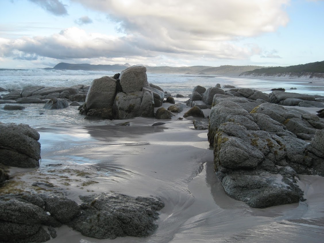
First, Bicheno. Say BEESH - uh - no. At Bicheno, there were huge granite rocks ...

... and a blow hole.

The large waves would bounce around a crack in the granite, spewing water high and far.

We watched and climbed around for a while.
The next beach was just north of Bicheno: the abandoned white sands of Denison Beach.

Jonathan wrote in the sand. I took off my shoes and waded in the waves.

And Tim searched the beach for stuff, like this guy he found up on the sand.

Third beach: Falmouth. Recommended for shells.

And indeed, there were many shells.


From Falmouth, Tasmania (not Cornwall), we turned west, back toward Devonport. We arrived early, and so explored one last beach for an hour ...
 |
| Devonport. |

Cabin shot.

The trip back was uneventful. The seas were calm. We slept the whole way.
Sunrise in Melbourne.

Welcome back, Real Life. *Sigh*.
2 comments:
Well - we should have stayed a few more days to see Tasmania.
Next time!
KP
Love the pictures...
-E
Post a Comment